Engineering > QUESTIONS & ANSWERS > Advanced GIS Exam 1 Latest 2022 with complete solution (All)
Advanced GIS Exam 1 Latest 2022 with complete solution
Document Content and Description Below
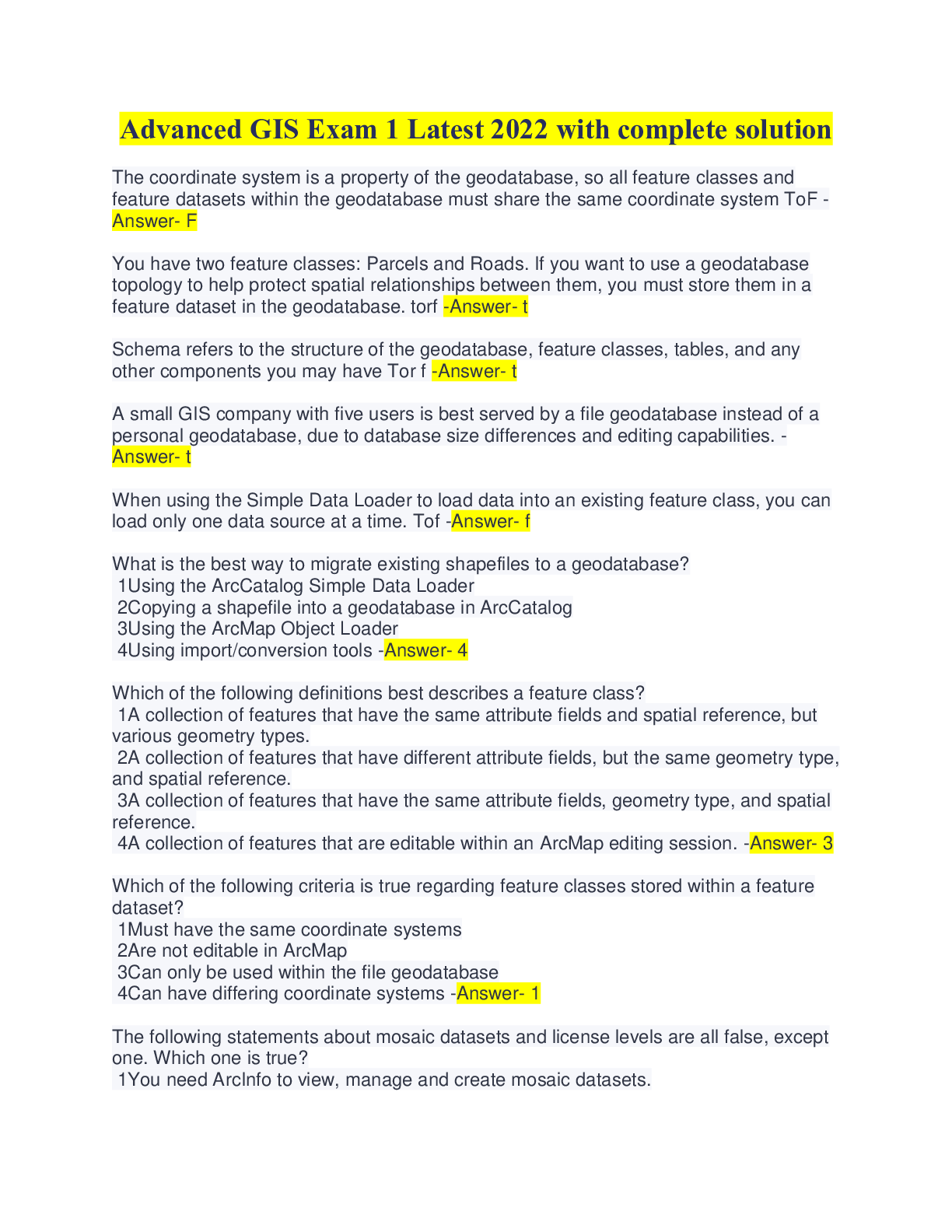
Advanced GIS Exam 1 Latest 2022 with complete solution The coordinate system is a property of the geodatabase, so all feature classes and feature datasets within the geodatabase must share the same ... coordinate system ToF - Answer- F You have two feature classes: Parcels and Roads. If you want to use a geodatabase topology to help protect spatial relationships between them, you must store them in a feature dataset in the geodatabase. torf -Answer- t Schema refers to the structure of the geodatabase, feature classes, tables, and any other components you may have Tor f -Answer- t A small GIS company with five users is best served by a file geodatabase instead of a personal geodatabase, due to database size differences and editing capabilities. - Answer- t When using the Simple Data Loader to load data into an existing feature class, you can load only one data source at a time. Tof -Answer- f What is the best way to migrate existing shapefiles to a geodatabase? 1Using the ArcCatalog Simple Data Loader 2Copying a shapefile into a geodatabase in ArcCatalog 3Using the ArcMap Object Loader 4Using import/conversion tools -Answer- 4 Which of the following definitions best describes a feature class? 1A collection of features that have the same attribute fields and spatial reference, but various geometry types. 2A collection of features that have different attribute fields, but the same geometry type, and spatial reference. 3A collection of features that have the same attribute fields, geometry type, and spatial reference. 4A collection of features that are editable within an ArcMap editing session. -Answer- 3 Which of the following criteria is true regarding feature classes stored within a feature dataset? 1Must have the same coordinate systems 2Are not editable in ArcMap 3Can only be used within the file geodatabase 4Can have differing coordinate systems -Answer- 1 The following statements about mosaic datasets and license levels are all false, except one. Which one is true? 1You need ArcInfo to view, manage and create mosaic datasets.2You can view mosaic datasets with ArcEditor, but you need ArcInfo to create and manage them. 3You can create, view, manage mosaic datasets with ArcEditor or ArcInfo. 4You can view and manage mosaic datasets with ArcEditor, but you need ArcInfo to create them. -Answer- 3 Which data format is similar to a feature class in a geodatabase, in that it only stores features that have same of geometry type? 1Shapefile 2AutoCad .DGN file 3ArcINFO coverage 4GRID -Answer- 1 Start ArcMap with a blank map. In the Catalog window, navigate to your ..\Student\GDB_Start10_0 folder and expand the AlachuaCounty.gdb file geodatabase. Which of the following components are present in AlachuaCounty.gdb? (Choose three.) 1Topology 2Mosaic dataset 3Feature dataset with feature classes 4Raster dataset 5Stand-alone feature class -Answer- 235 Which of the following actions cause a change in schema? 1Digitizing a new line 2Changing the shape of a polygon 3Updating an attribute value 4Deleting a field -Answer- 4 Which of the following criteria is true regarding feature classes stored within a feature dataset? 1Can only be used within the file geodatabase 2Can have differing coordinate systems 3Are not editable in ArcMap 4Must have the same coordinate systems -Answer- 4 You currently store your data in a personal geodatabase. You want to migrate this data into a file geodatabase. You want to combine 10 feature classes of roads into one feature class for easier data management. The roads feature classes share the same spatial reference and fields. Which of the following workflows offers the best solution? 1Purchase additional software required for file geodatabase. Create a new feature class. Convert all 10 roads feature classes into the new empty feature class. 2Create a new file geodatabase. Create a new roads feature class. Import the schema from one of the roads shapefiles.Use conversion tools to convert all 10 roads shapefiles into one new one. 3Create a new file geodatabase. Create a new roads feature class. Import the schema from one of the roads shapefiles. Use the Simple Data Loader to load all 10 roads shapefiles at once. 4Delete your current roads in the personal geodatabase. Convert the original roads shapefiles into a new file geodatabase. -Answer- 3 If you are converting a coverage into a geodatabase feature class. Which of the following considerations are valid? (Choose two.) 1You must have an ArcInfo license to convert coverages into a geodatabase. 2You must delete coverage specific fields, such as AREA, PERIMETER, COVER#, COVER-ID. 3You must keep the Coverage specific fields, such as AREA, PERIMETER, COVER#, COVER-ID, after the conversion. 4Each feature class within a coverage will become an individual feature class in the geodatabase. -Answer- 24 Why would you want to create a feature dataset in your geodatabase? 1All geodatabases must contain at least one feature dataset. 2You have several shapefiles that you want to combine and a feature dataset is the best way to accomplish that. 3You view feature datasets as a great way to organize feature classes by geometry type. 4You want to create a geodatabase component that requires you to have a feature classes in a feature dataset, such as a topology or geometric network. -Answer- 4 What is a mosaic dataset? 1A collection of feature classes that are managed as one entity 2A single raster image 3A data model for storing and managing raster data in the geodatabase 4Multiple feature datasets used to manage spatially related feature classes -Answer- 3 Which of the following are considered to be schema? (Choose three.) 1Attribute values in a table 2Map documents that store layers referencing geodatabase feature classes 3Points, line, and polygon features 4Spatial reference of a feature class or feature dataset 5An empty feature class 6Fields in a table -Answer- 456 When creating mosaic datasets, which of the following are best practices? (Choose two.) 1Building pyramids on the raster datasets2Using the WGS 1984 Web Mercator Auxiliary projection for use on the web 3Adding rasters into a feature dataset 4Using UTM or State Plane coordinate systems -Answer- 12 You have existing data stored in shapefiles, coverages, and CAD files. What is the most effective way to get your data into a geodatabase? 1Create an empty geodatabase and empty feature classes, then use the Simple Data Loader. 2Recreate all of the data from scratch. 3Convert/import all existing data formats into the geodatabase as feature classes. 4Use XML data exchange. -Answer- 3 You are the GIS coordinator for a large company that wants to give many people the ability to view and edit data stored in geodatabase simultaneously. What type of geodatabase would be required? 1Microsoft Access 2Multiuser 3File 4Personal -Answer- 2 The spatial information of a topographic map displayed in the map sheet margins is the most accurate information for this dataset. tof -Answer- t Any aerial imagery with reasonable distortions could be integrated into a GIS project. tof -Answer- t ArcMap cannot draw nongeoreferenced raster datasets. tof -Answer- f Regardless of the original raster dataset and georeferencing method, a reference layer is always required. tof -Answer- f You have a satellite image depicting Southern California that has been orthorectified. To reduce the file size, you clip out your study area and save the clip in *.tiff format. You need to georeference the image again to be able to use it in a GIS project. tof -Answerf Georeferenced raster data is suitable for advanced GIS analyses. -Answer- t You have a historic scanned map of Houston, Texas. The image has been used in GIS projects before, but in a different projection. You need to georeference the image again to align it with your current spatial data. tof -Answer- f Which data formats can be used as reference data in auto registration? 1Only raster data 2Raster and vector data 3Multiple reference layers4Metadata in map sheet margins -Answer- 4 What are the requirements for a reference layer? (Choose two.) 1Must be a raster layer 2Extent is defined 3Covers a larger extent than the nongeoreferenced raster dataset 4Projection is defined 5Has the same texture as the nongeoreferenced layer -Answer- 24 The links in auto registration are based on: 1The spatial information in the map sheet margins. 2Texture of the datasets. 3Similar lines in the raster image and a reference map. 4Cell size of the reference data. -Answer- 2 What are some reasons that a raster image would not line up with the reference data? (Choose two.) 1The extent was not defined. 2The aerial image was not orthorectified. 3The spatial reference was undefined. 4The data was in different projection than the reference data. -Answer- 13 You work as an intern in a map library and have been assigned to digitize all the maps in the library holdings. You have already scanned the maps and stored them as JPEGs. You must now georeference the maps, and you have been asked to keep the source data clean and unaltered and to ensure data interoperability. How should you save the georeferenced file? 1Resample 2Update georeferencing 3Save it as a .xml file 4Rectify -Answer- 4 Which of the following accurately describes the process of georeferencing? 1Correcting the geometry of an image for measuring purposes 2Adjusting the coordinates of all the data points in a dataset to allow a more accurate match between known locations and a few data points within the dataset 3Placing an image from pixel space into a known coordinate system 4Converting addresses into spatial data -Answer- 3 After a mine fire and the complete closure of the mining area, the population of Centralia, Pennsylvania, has dwindled. In 1981, the population was 1,000; in 2005, the population was 12. To visualize the drastic change in the area, you want to overlay an historic aerial photo that has no spatial information on the left with a current orthophoto of the area on the right. Which georeferencing workflow would you have to apply? 1Set a data frame projection > zoom to the reference raster with spatial information > click Fit to Display > update georeferencing.2Set a data frame projection > open the nongeoreferenced raster in a Image Viewer window > add links manually > evaluate the links > save the results. 3Set a data frame projection > overlay the datasets > apply auto registration > evaluate the links > save the results. 4Set a data frame projection > display the nongeoreferenced layer in its proper location on earth > apply a transformation > resample the data > save the results. -Answer- 2 Which features make good control points for georeferencing? (Choose two.) 1Rooftops 2Patterns on the ground 3Bridges 4Parked cars -Answer- 23 In auto registration, which step in the georeferencing process is automated? 1Defining a transformation 2Evaluating links 3Creating links 4Resampling data -Answer- 3 What are some possible sources of high RMS error? (Choose two.) 1Unsuitable transformation method 2Similar control points 3Misplaced control points 4Concentration of the control points in a small area -Answer- 23 Which is the best fitting projection you should use for georeferencing a raster dataset? 1The original projection in which the raster dataset was created 2The most current projection used in the area 3The projection of the most current reference data 4The projection of the dataset covering the largest area -Answer- 1 How many links should you create to ensure accurate georeferencing? 1Three 2One in every corner and one in the center of the raster image 3The number depends on the transformation method you plan to use 4As many as possible -Answer- 3 Historic data can provide great value for a GIS project. Georeferencing allows you to integrate old data, including scanned maps and aerial imagery, with your current spatial data. What are some of the steps you should follow to ensure a proper alignment of your datasets? (Choose two.) 1Project the data in the data frame in the scanned map's original projection. 2Tie your control points to the stable points on the ground. 3Use only raster data to georeference scanned imagery. 4Focus your control points in one small area. -Answer- 12Which processes are involved in every georeferencing workflow? (Choose three.) 1Evaluate links 2Permanently transform the dataset 3Resample data 4Create links 5Reproject data -Answer- 134 Two feature classes, Highways and Local roads, contain the same fields. One way to organize this data is to combine the feature classes into one larger feature class and then create subtypes. -Answer- t Range domain attribute data that has not been validated can be saved in the feature class. -Answer- t When you create subtypes, you must enter a code and a description for each subtype - Answer- t When a file geodatabase is copied to a new location, the user who created the domains in the source geodatabase is also the owner of the domains in the destination geodatabase. -Answer- t An attribute domain can be applied to a subtype. -Answer- t The same attribute domain can be used for feature classes as well as nonspatial tables. -Answer- t Hurricanes are classified by category using the numeric values 1, 2, 3, 4, and 5. You need to add data like this to the geodatabase and would like to define a domain. In this case, you would define a range domain. -Answer- f A user starts an edit session and adds a new Fish feature. The user opens the Attributes window and clicks the cell to update the Fish field. However, a list of coded values does not display in a drop-down list. What does the user need to do for the drop-down list to display? 1From the FishSpecies feature class properties, click the field Fish. 2Create a new range domain. 3From the FishSpecies feature class properties, click the field Fish, then in Field Properties, choose the FishSpecies domain. 4From the FishSpecies feature class properties, click the field Fish, and make sure a default value is assigned. -Answer- 3 Which of the following statements accurately describes one way that the geodatabase can help enforce data integrity? (Choose three.) 1Default values populate fields without user intervention. 2Fields can be populated automatically with null values. 3Coded value domains present a list of valid choices when editing.4Range domains present a list of valid choices during an edit session. 5Invalid numeric values are automatically validated. -Answer- 123 Attribute domains are a property of which of the following? 1Table 2Feature class 3Feature dataset 4Geodatabase -Answer- 4 Which of the following data types can be used as a subtype field? 1Any numeric data type 2Double and float 3Text field 4Short integer and long integer -Answer- 4 A single attribute domain can be associated with which of the following? (Choose two.) 1A maximum of one field in a single feature class 2More than one field in a single feature class 3One or more fields in each of several feature classes 4One field in one feature class -Answer- 23 The Validate Features command checks for errors in attribute fields associated with which of the following? 1Subtype codes 2Range domains only 3Coded value domains only 4Both range and coded value domains -Answer- 2 When a feature class has subtypes, which options are valid for working with domains? (Choose two.) 1A domain can be added at any time to the geodatabase. 2Domains must be applied at the subtype level. 3The domain field type can be modified. 4Domains must be applied at the field level. -Answer- 12 Click WaterMainSize to display its field properties. The Domain field property is not listed. Why? 4The data type for a range domain must be Double in order to support fractional sizes of water mains. 1The domain and the feature class must have the same names. 2The field types for the WaterMainDiameter domain and the WaterMainSize field must be the same. 3The data type for a range domain cannot be Long Integer. -Answer- 2Open ArcMap and review the Subdivision.gdb geodatabase that you worked with in the Create and use attribute domains exercise. What type of attribute field can the LateralLineSize domain be applied to? Double Long integer Text Float -Answer- double Attribute domains are rules that describe the permissible values of a field type. You can use them to constrain the attribute values allowed for which of the following geodatabase components? (Choose three.) 1Feature dataset 2Field 3Subtype 4Feature class 5Table -Answer- 135 What do you need to do to apply multiple attribute domains to a single field? 1Divide the feature class into multiple coded value domains and assign a default value. 2Divide the feature class into domains and apply a different subtype to each domain. 3Divide the feature class into subtypes and apply a different domain to each subtype. 4Divide the feature class into multiple subtypes and assign a default value. -Answer- 3 Which of the following statements are true about subtypes and domains? (Choose three.) 1A subtype is a property of the geodatabase while a domain is a property of a feature class. 2You can create a domain without associating the domain with subtypes. 3A domain is a property of the geodatabase while a subtype is a property of a feature class. 4Instead of creating many feature classes, one way to organize your data is to use attribute domains instead. 5You can create a subtype without associating the subtype with a domain. -Answer- 235 How would you add a new well type to the Wells feature class in your exercise data? 1Add a new domain to the geodatabase properties. 2Open the Wells feature class properties and add a new domain. 3Open the Wells feature class properties and add a new field to the table. 4Open the Wells feature class properties and add a new subtype. -Answer- 4 You have created a new attribute domain. What must you do before you can use it to validate attribute values? 1Check for errors in the domain using the Validate Features command. 2Apply it to selected features using the Attributes dialog box in ArcMap. 3Create a relationship between the domain and the feature class you want to validate.4Apply it to an attribute field using the Feature Class Properties dialog box. -Answer- 4 Which of the following statements about range domains and coded value domains is true? 1Range domains must be integers, while coded value domains must be text. 2Range domains specify starting and ending values, while coded value domains list acceptable values. 3Range domains can be applied to only one attribute field, while coded value domains can be applied to multiple attributes. 4Validation for range domains is automatic, while validation for coded value domains is interactive -Answer- 2 Analysis and reference are two main purposes for data. -Answer- t If you add a map service from ArcGIS Online, you will see it in the Catalog window - Answer- f Your project requires that you use street data. You have found both a shapefile and a geodatabase feature class that meet your requirements. You should choose to download the feature class in order to use its additional functionality. -Answer- t You would like to use land cover data for analysis. A polygon feature class of land cover is a suitable format for your project. -Answer- f [Show More]
Last updated: 1 year ago
Preview 1 out of 21 pages
Reviews( 0 )
Recommended For You
Medicine> QUESTIONS & ANSWERS > PHTLS Pre & Post Test 2022 With Complete Solution(Graded A+) (All)

PHTLS Pre & Post Test 2022 With Complete Solution(Graded A+)
PHTLS Pre & Post Test 2022 with Complete Solution (Graded A+) The displacement of tissue away from the path of a projectile, both temporarily and permanently, is known as: A. Conization B. Ca...
By Excel , Uploaded: Sep 02, 2022
$10.5
Health Care> QUESTIONS & ANSWERS > Texas Fire Alarm Practice Test 2022 with complete solution (All)
Texas Fire Alarm Practice Test 2022 with complete solution
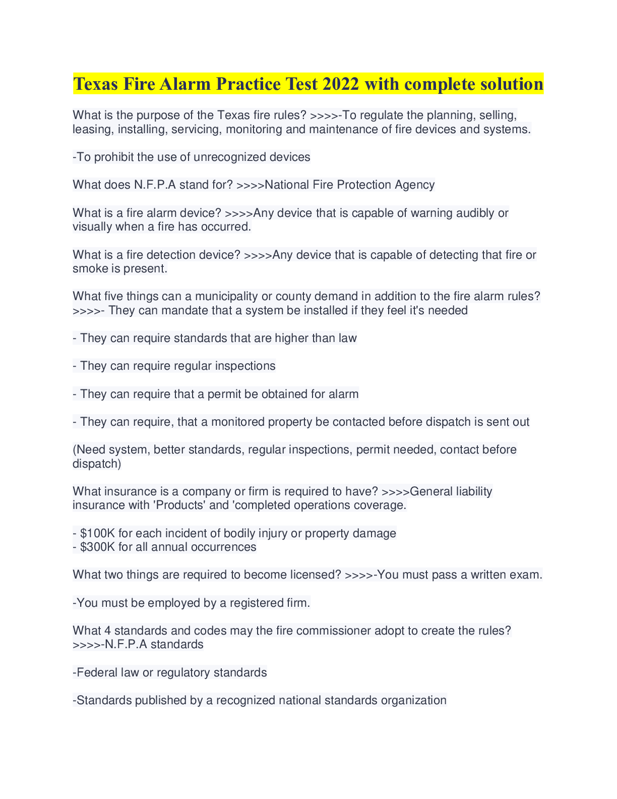
Texas Fire Alarm Practice Test 2022 with complete solution What is the purpose of the Texas fire rules? >>>>-To regulate the planning, selling, leasing, installing, servicing, monitoring and mainten...
By Excel , Uploaded: Aug 31, 2022
$6.5
Legal Environment in Business> QUESTIONS & ANSWERS > NY Notary Exam Questions 2022 with COMPLETE SOLUTION (All)

NY Notary Exam Questions 2022 with COMPLETE SOLUTION
NY Notary Exam Questions 2022 with COMPLETE SOLUTION 1) If a Notary refuses to notarize an affidavit presented for NY notary Mobile services. What is the potential maximum jail sentence? A. One mo...
By Prof.Pierro , Uploaded: Jul 01, 2022
$11.5
Social Sciences> QUESTIONS & ANSWERS > 109 NY Notary Exam Questions 2022 with COMPLETE SOLUTION (All)
109 NY Notary Exam Questions 2022 with COMPLETE SOLUTION
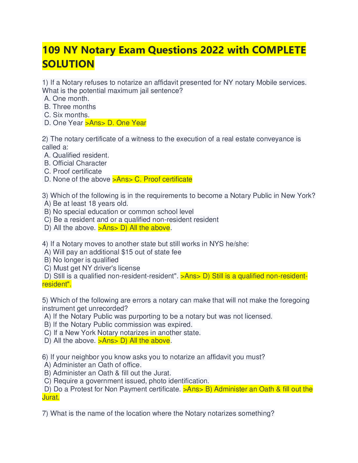
109 NY Notary Exam Questions 2022 with COMPLETE SOLUTION 1) If a Notary refuses to notarize an affidavit presented for NY notary Mobile services. What is the potential maximum jail sentence? A. One...
By Professor Lynne , Uploaded: Aug 10, 2022
$9
*NURSING> QUESTIONS & ANSWERS > ATI closed-chest pretest 2022 with complete solution (All)
ATI closed-chest pretest 2022 with complete solution
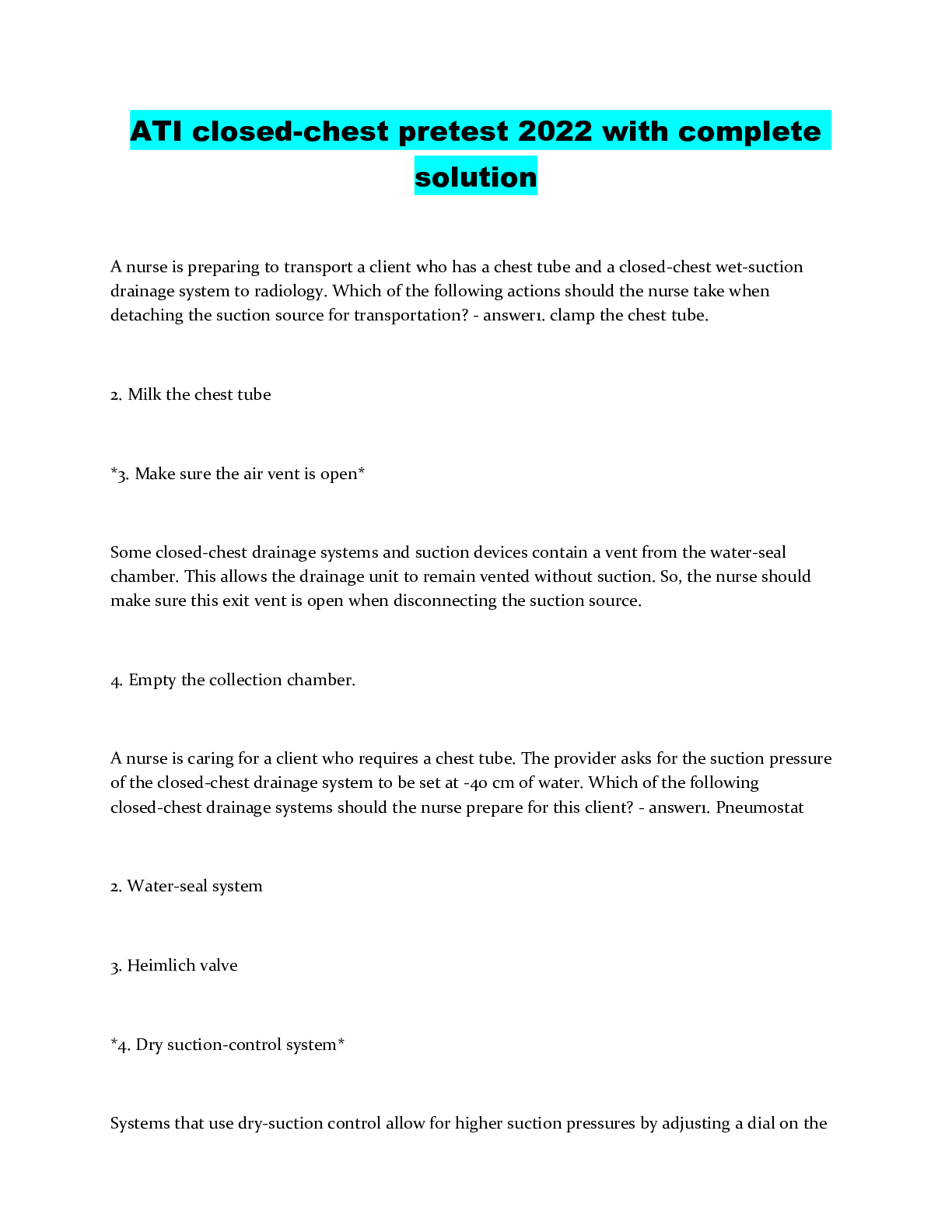
ATI closed-chest pretest 2022 with complete solution
By luzlinkuz , Uploaded: Aug 08, 2022
$8
Medicine> QUESTIONS & ANSWERS > FISDAP Paramedic Final Exam 2022 with complete solution Guaranteed Score A+ (All)

FISDAP Paramedic Final Exam 2022 with complete solution Guaranteed Score A+
You have received an order for a dopamine drip. You carry 500cc bags of D5W. How much dopamine should you add to the bag to create a 1600mcg/1mL dilution? A. 800mg B. 1600mcg C. 1600mg D. 400mcg -...
By Nancylect , Uploaded: Aug 02, 2022
$15
*NURSING> QUESTIONS & ANSWERS > CBCS Study Guide 2022 WITH COMPLETE QUESTIONS AND ANSWERS (All)

CBCS Study Guide 2022 WITH COMPLETE QUESTIONS AND ANSWERS
CBCS Study Guide 2022 WITH COMPLETE QUESTIONS AND ANSWERS
By luzlinkuz , Uploaded: Jul 31, 2022
$7.5
*NURSING> QUESTIONS & ANSWERS > FTCE Prek-3 Practice Test 2022 with complete solution (All)

FTCE Prek-3 Practice Test 2022 with complete solution
FTCE Prek-3 Practice Test 2022 with complete solution
By luzlinkuz , Uploaded: Jul 31, 2022
$6.5
Art> QUESTIONS & ANSWERS > THEATER EXAM 2 CARSON 2022 with complete solution (All)

THEATER EXAM 2 CARSON 2022 with complete solution
False - ANSWER Most lighting is hung at a 90-degree angle Focused - ANSWER When a beam of light is aimed at a particular area on the stage, its said to be _____ A template which determined the p...
By MARKALLAN , Uploaded: Jul 30, 2022
$6
*NURSING> QUESTIONS & ANSWERS > OB INPATIENT CERTIFICATION TEST 2022 WITH COMPLETE SOLUTION (All)

OB INPATIENT CERTIFICATION TEST 2022 WITH COMPLETE SOLUTION
OB INPATIENT CERTIFICATION TEST 2022 WITH COMPLETE SOLUTION
By luzlinkuz , Uploaded: Jul 29, 2022
$7
Document information
Connected school, study & course
About the document
Uploaded On
Jan 10, 2023
Number of pages
21
Written in
Additional information
This document has been written for:
Uploaded
Jan 10, 2023
Downloads
0
Views
64


